Numerical River Modelling
River Rhine "Mehrum" Section Case Study
Preparation of the GIS project
- create a new project folder and a new ArcGIS map
- change the default properties of the data frame -> Layers -> Properties
-> Coordinate reference system:ETRS 1989 UTM Zone 32N
Part 1: Import of the River Rhine cross section point data
Step-by-Step
- add Rhein_punkte.txt to GIS Map
using import tool: 3D Analyst Tools -> Conversion -> From File -> ASCII 3D to Feature Class
use as parameter :
Input File Format -> GENERATE
Output Feature Class Type -> POINT
Coordinate System -> DHDN_3_Degree_Gauss_Zone_2
(Gauss-Krüger Potsdam Datum Zone 2) EPSG 31466
predefined CRS in ArcGIS: Projected Coordinate Systems -> National Grids -> Germany
- adapt data CRS to map CRS
using tool:Data Management Tools -> Projections and Transformations -> Project
new CRS: ETRS_1989_UTM_Zone_32N EPSG 25832
using Transformation DHDN_To_ETRS_1989_4
- add z coordinate (elevation) to attributes
using tool:Data Management Tools -> Add Geometry Attributes
or/and 3D Analyst Tools -> 3D Features -> Add Z Information
- adapt visualization using new field (elevation)
select Properties for the shape file -> Symbology
change the standard symbols to other modes
(e.g. Quantities -> Graduated colors -> use Z )
Part 2: Import of the Polder Mehrum DEM
Step-by-Step
- add dgmfull.e00 to GIS Map
using import tool: Conersion Tools -> To Coverage -> Import from E00
- adapt data CRS to map CRS
using tool: Data Management Tools -> Projections and Transformations -> Raster -> Project Raster
new CRS: ETRS_1989_UTM_Zone_32N EPSG 25832
using Transformation DHDN_To_ETRS_1989_4
- add PolderMehrumMesh.dat to GIS Map
rename PolderMehrumMesh.dat to PolderMehrumMesh.txt
using import tool: 3D Analyst Tools -> Conversion -> From File -> ASCII 3D to Feature Class
Input File Format -> GENERATE
Output Feature Class Type -> POINT
Coordinate System -> DHDN_3_Degree_Gauss_Zone_2
(Gauss-Krüger Potsdam Datum Zone 2), EPSG 31466
predefined CRS in ArcGIS: Projected Coordinate Systems -> National Grids -> Germany
- adapt data CRS to map CRS
using project tool: Data Management Tools -> Projections and Transformations -> Project
new CRS: ETRS_1989_UTM_Zone_32N EPSG 25832
using Transformation DHDN_To_ETRS_1989_4
- add z coordinate (elevation) to attributes
using tool: Data Management Tools -> Add Geometry Attributes
or/and 3D Analyst Tools -> 3D Features -> Add Z Information
- adapt visualization using elevation
select Properties Symbology
choose same visualization rules/limits as for the other elevation data
Part 3: Additional GIS data and services
WMS-Services
- navigation map (recommended)
WMS Server: https://via.bund.de/wsv/ienc/wms?
Service Name: InlandENCs der WSV
- topographical map
WMS Server: https://www.wms.nrw.de/geobasis/wms_nw_dtk100
Service Name: WMS NW DTK100
WMS Server: https://www.wms.nrw.de/geobasis/wms_nw_dtk10
Service Name: WMS NW DTK10
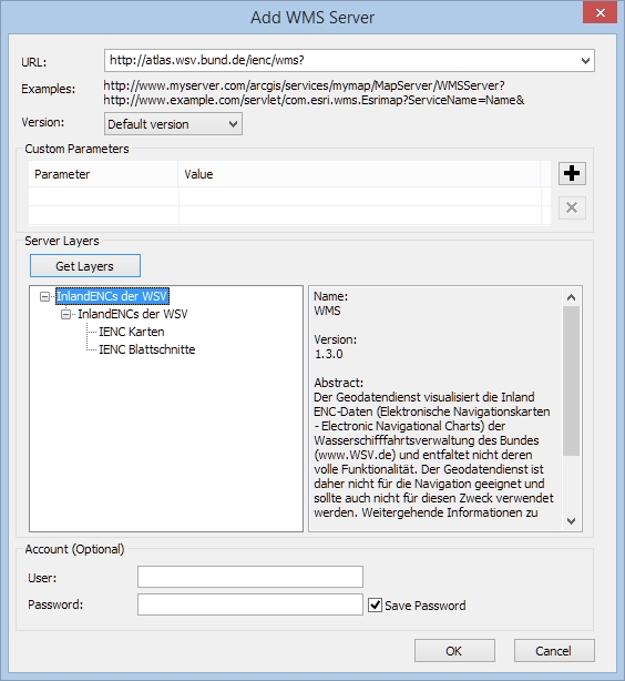
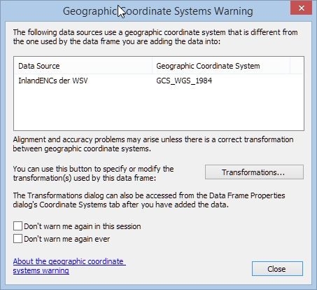
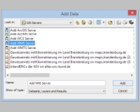
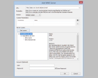
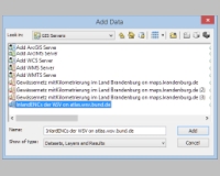
How to add WMS services to your map ?
example: https://via.bund.de/wsv/ienc/wms?
click on the thumbnails to get full images:
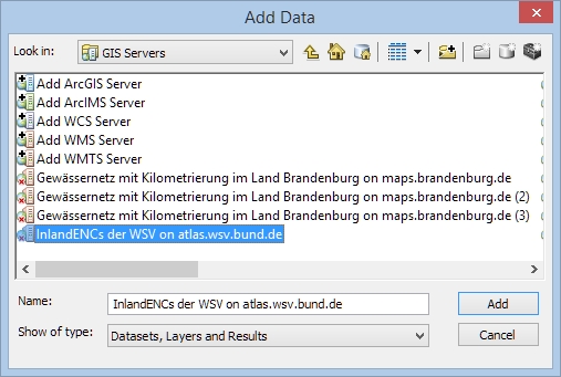
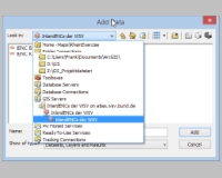
use the Add Data Icon, select GIS Servers and Add WMS service:
specify the URL of the WMS service, click on Get Layers, select the service you need
select the new insert WMS service in the list of WMS servies:
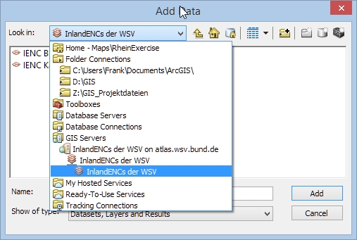
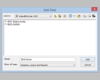
select the map you need (here IENC Karten (maps)):
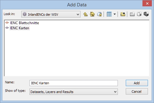
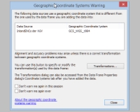
the sevice is using WGS84, transformation should be done automatically:
Shape files / raster data
- Gewässerstationierungskarte NRW: water body chainage / positioning map)- (recommended)
Link: https://www.opengeodata.nrw.de/produkte/umwelt_klima/wasser/oberflaechengewaesser/gsk3c/
gsk3c_stationierung.shp -> chainage points
gsk3c_gew_kanal_plm.shp -> river polyline
gsk3c_gew_flaeche.shp -> river polygon (main river bed)
- Überschwemmungsgebiete in NRW als Shape
Link: https://www.opengeodata.nrw.de/produkte/umwelt_klima/wasser/hochwasser/uesg/
festgesetzte_Ueberschwemmungsgebiete.shp -> river polygon (main river bed plus flood plains)
- Digital Topograhical Maps
Link: https://www.opengeodata.nrw.de/produkte/geobasis/tk/
- SRTM Germany
Link: http://www.opendem.info/download_srtm.html
- Openstreetmap Nordrhein-Westfalen
Link: 0http://download.geofabrik.de/europe/germany/nordrhein-westfalen.html